
Ma distance de sécurité
Published:
Ma distance de sécurité is a web and mobile application that helps users maintain social distancing during the COVID-19 pandemic. It was developed as a side project during the lockdown in France in March 2020, and utilizes the haversine distance formula to compute the distance between two geographical points, using the Google Maps API to track user positions and distances.
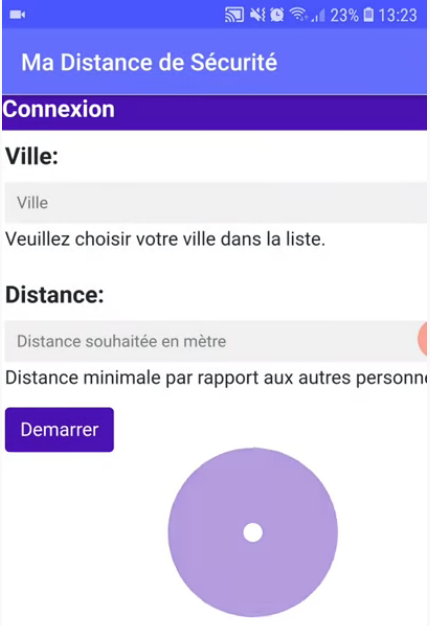
The user interface of the application includes two fields, “Ville” (city) and “Distance”, where users can set the city location and the minimum distance they wish to keep from other users. Once the user starts the tracking, the distance is tracked until the user stops it.
The project provided me an opportunity to learn new skills, such as developing an Android application and deploying a website on Google Cloud. The development process utilized Python (Flask), JavaScript, HTML, CSS, Bootstrap, MySQL, Android, and Google Cloud. The code source for the project is available here.